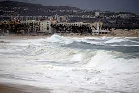
After gaining a significant amount of intensity overnight, Hurricane Hilary continued her trek northward towards the coasts of California and Mexico while maintaining its status as a Category 4 storm.
According to an advisory issued by the United States National Hurricane Centre at two o’clock local time, Hilary’s winds were unvarying at 145 miles (233 km) per hour as of that time. Hilary was fueled by warm water. It is anticipated that Hurricane Hilary will make landfall in Mexico during the course of the weekend before bringing heavy rainfall to California and the Southwest of the United States through Monday.
According to the hurricane centre, tropical storm watches have been issued for all of California, beginning at the state’s border with Mexico and extending as far north as Los Angeles and Orange counties. Watches and warnings for hurricanes and tropical storms have also been issued throughout much of the coastline of Mexico’s Baja California state, as well as along parts of Mexico’s mainland shore. From late Friday night through Sunday, there is a good chance that the entire peninsula will be hit with heavy rains that could set off landslides.

According to Adam Douty, a meteorologist with the commercial forecasting company AccuWeather Inc., the storm has the potential to become even more powerful, possibly even reaching the maximum Category 5 strength on the Saffir-Simpson scale, before beginning to weaken as it moves over cooler water. This might happen before the storm begins to ease as it moves over cooler water.
“By the time it approaches land, its intensity should have diminished considerably,” he said.
According to the hurricane centre, by the time Hurricane Hilary makes landfall in Baja California, Mexico, its gusts should have decreased to about 75 mph. As the storm advances into California late Sunday evening, it will likely be a tropical storm, and it will weaken as it moves inland.
Downpours
Nonetheless, Hilary is expected to deliver widespread heavy rainfall to California and the Southwestern United States, increasing the risk of power outages, mudslides, flooding, and disruptions to ground and air travel. The rain could begin in the region as early as Saturday, with the heaviest downpours occurring Sunday night and Monday.
According to Douty, a wide area could receive 2 to 4 inches of precipitation, which would be comparable to the potent winter storms that occasionally cause flooding in California. He stated that desert communities such as Palm Springs and the numerous railway lines that traverse the region and pass through the mountains could also be at risk.
Michael Brennan, the director of the hurricane centre, stated in a video briefing that some areas may receive more precipitation than they normally do in a year. In the past decade, he said, the primary cause of death from tropical systems has been flooding from rains.
ALSO READ : Samsung Galaxy Z Fold 5, Z Flip 5 first sale in India today: Price, specs and more .
Los Angeles, San Diego, and Las Vegas are included in the regions of California, Arizona, Nevada, and Utah under flood forecasts. The California Governor’s Office of Emergency Services stated in a statement that flooding could be worst in Southern California, particularly around San Diego.


